Advice and Ideas on Choosing a Topic
Some people find it easy to choose a topic for their dissertation, but for others it can be the hardest part of the whole process. There is a lot of Geography to choose from, and you haven’t done a dissertation before, so we appreciate that you might need some advice at this point
There is a useful chapter called “What shall I do it on?” in the “How to do your dissertation. ” textbook by Parsons and Knight (2005). and further advice in the dissertation handbook and the Supplementary Advice document You can also talk to members of staff to get feedback on your ideas. There is also a list of some Previous dissertation titles that students have used before.
Topic Ideas
To give you a bit more help, the Geography staff are listing some topic ideas on this page. You don’t have to use one of these ideas (you can still make up your own project on any topic you want), but we thought that having a list like this might be useful if you didn’t know where to start. Some of the project ideas in our list are just titles or broad topic areas, but others give you some additional detail and suggested start-up reading. When you fill in your Dissertation Form 1 you may, if you wish, use one of these listed topics as the starting point for your dissertation.
The list below is divided into broadly Physical Geography topics, broadly Human Geography topics, and Geographical topics that span aspects of the whole discipline. You may also wish to combine elements of different topics to create an original idea of your own!
Some Broadly PHYSICAL GEOGRAPHY topics:
Assessing the geoconservation value of Staffordshire’s geomorphology GeoConservation Staffordshire is a group responsible for designating, conserving and promoting a wider awareness of the county’s “geodiversity”.
Whilst the group has identified a range of important geological sites, the number of important geomorphological sites identified within Staffordshire is very limited. This project would identify the range of regionally significant geomorphological sites within the county and consider their geoconservation value from a variety of perspectives (e.g. accessibility, educational value etc.). A high quality project would provide a report that the GeoConservation group and possibly Natural England could use in the future in their efforts to promote a wider awareness of geodiversity.
A number of opportunities exist for students to work on projects associated with an ongoing programme of research in the Dyfi Estuary, west Wales. However, many of these topics could easily be applied in the context of other salt marshes, both in the UK and overseas. These projects are likely to include a significant field and laboratory component. Possible projects could include:
- Salt-marsh vegetation zonation in the Dyfi Estuary, west Wales, UK
- Salt-marsh vegetation zonation in the Maddawach Estuary, west Wales, UK.
- Using geophysics to map the spatial extent and key sedimentary units in the Dyfi Estuary, west Wales, UK
- Trace metals in salt-marsh sediments
- Investigating the links between nutrient content and salt-marsh vegetation diversity
Four Ashes is a very important Quaternary SSSI that represents the type site for the “Devensian” (the most recent glacial period).

Work contracted by Natural England will shortly be re-exposing part of the original exposure which will provide an ideal opportunity to re-appeaise the original work undertaken by Morgan (1973). This project will involve logging the section, identifying the facies and the applying sedimentological techniques such as particle size and clast fabric analysis in order to identify the site’s palaeoenvironmental and palaeoglaciological history.
There are many projects you could base on mountain streams, and there are plenty of convenient mountain streams in the UK. For example you could look at how step-pools form and evolve, or how they respond to flood events. A convenient review of step-pools is provided by Chin and Wohl (2005) Progress in Physical Geography Vol. 29 pp. 275296. and an example of research looking at how step pools respond to flooding is provided by Molnar, et al. (2010) Geomorphology Volume 124, Pages 85-94. Both available online through Keele Library .
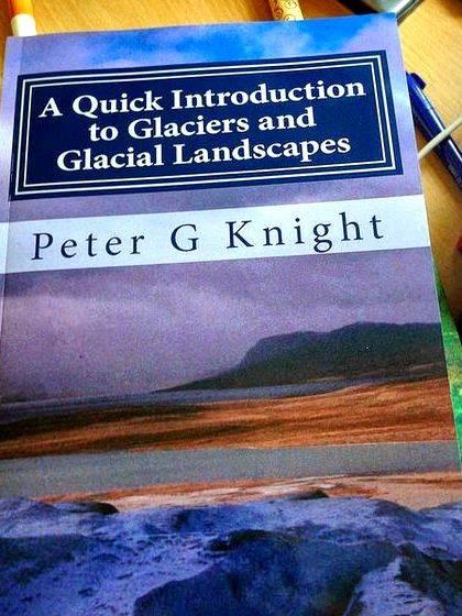
There are several things you could do in Keele’s low-temperature lab to study the origin and significance of glacier basal ice. For example, you could test the hypothesis that herringbone facies supercooled ice (which can be created in the lab) transforms diagenetically into stratified or dispersed facies ice under strain.
Reading:
- Cook, S.J. Knight, P.G. Waller, R.I. Robinson, Z.P. and Adam, W.G. (2007) The geography of basal ice and its relationship to glaciohydraulic supercooling: Svínafellsjökull, southeast Iceland. QUATERNARY SCIENCE REVIEWS 26 (19-21) 2309-2315.
- Knight, P.G. and Knight D.A. (2006) Laboratory observations of ice formation and debris entrainment by freezing turbid supercooled water. In Knight, P.G. (ed.) GLACIER SCIENCE AND ENVIRONMENTAL CHANGE (Blackwell, Oxford).
Projects could involve the investigation of past glacial and periglacial landforms and sediments in order to identify their origin or to reconstruct past environmental conditions. These could involve the use of a range of techniques including field mapping, sedimentological analyses, GIS mapping using digital elevation model data and laboratory simulations. Specific project ideas include:
- Reconstruction of Loch Lomond stadial glaciers in Snowdonia.
- The use of summit blockfields to reconstruct the extent of mountain glaciations.
- Determining the origin of meltwater channels within the local area.
- Laboratory simulation of the controls on palsa formation.
Various authors over several decades have suggested that the geomorphology around Church Stretton reflects ice-marginal processes, but the picture remains unclear and new DEM data that are available might help to resolve some of the controversy. The reference below gives you a starter illustration of the field area.
Pannett, D. (2008). The Ice Age Legacy in North Shropshire. Proceedings of the Shropshire Geological
Society, 13, 8691 (direct link to .pdf file)
We do have a low-temperature laboratory (walk-in freezer) in which you could do lots of different experiments. Classic Physical Geography topics include “what controls the rate or style of. frost shattering, or frost heave, or ice-wedge formation. ” You’d need to be careful not just to repeat work that is well established, but there are still interesting little questions that could be addressed by using different materials, different environmental contexts (wet, dry, etc) and different thermal regimes. The reference below flags up some of the controversial issues.
Hall, K. and Thorn, C. (2010) The historical legacy of spatial scales in freezethaw weathering: Misrepresentation and resulting misdirection. Geomorphology (in press as of Jan 2011) direct link to pdf file.
Projects might examine the nature and human impact of a variety of different natural hazards. These could involve a variety of techniques, including the analysis of secondary data, GIS mapping, questionnaire surveys and structured interviews. Specific project possibilities include:
- Mapping landslide susceptibility within the Peak District.
- Investigating the controls on the changing frequency of flood events in a variety of catchments.
- Comparing the influence of climate change on the actual and perceived level of risk posed by a variety of hazards.
- Determining the cause of a 17th Century flood event in the Bristol Channel.
Projects might examine spatial and temporal variations in weather and climate at a variety of scales, their controls and their wider implications. These have could include the acquisition and analysis of datasets from external agencies (e.g. the Met Office) as well as the use of the long-term climate data collected at the Keele Met Station. Specific project possibilities include:
- Investigating the changing the incidence of high intensity rainfall events in the Keele area.
- Determining the influence of parkland on the magnitude of urban heat islands.
- Identifying the controls on the changing incidence of windstorm events in the U.K.
- The use of lichen size and diversity to determine atmospheric pollution associated with the M6.
The coastal environment provides a wide range of opportunities for dissertation projects. Some possible project ideas, which could be conducted in various parts of the UK coastline, or even overseas, include:
- Investigating the controls on sand dune vegetation diversity
- Investigating the seasonal variability of sediment size and shape on a UK beach
- Temporal and spatial variability of UK beach (swash zone) water quality in relation to EU bathing standards
Easy access to contemporary and historic Ordnance Survey datasets through the Digimap service provides opportunity for studies involving landscape change including predictive modelling. A particular application area lies in the uses of GIS with such data to measure changes in the coastal zone in the context of various explanatory variables the relationship between rates of cliff line recession and shoreline protection measures would be one example. Investigations involving predictions of future coastal zone losses based upon measured historical rates might also be considered. It would also be feasible to predict and map the impact of various sea-level rise scenarios on low lying coastal regions.
Opportunities exist for students to contribute to an existing programme of research, in collaboration with the UK National Police Improvements Agency, examining the use of different geophysical search techniques for finding murder victims, whose bodies have been buried in coastal environments. Such projects would suit students with previous geophysics experience and/or with a strong interest in geophysics, but would need to be designed in such a way as to fall within the remit of a Geography Dissertation, ie focussing on Geographical questions or evidence. Such projects are likely to include some desk-based research as well a significant field work component. Note that these projects involve the use of manikins, and not real dead bodies!!
Some Broadly HUMAN GEOGRAPHY topics:
There are plentiful opportunities for dissertations which make use of secondary data and GIS capabilities to investigate accessibility to services and facilities and the equity of such provision. Such investigations can often be set within the context of government accessibility targets or changes to levels of access brought about by rationalisation or restructuring of services very topical in the current economic climate or in the context of inverse care or territorial justice. Specific topics that might be considered might include Post Office services; primary or secondary health care; green space; food choice; library services; young people’s services or caravan site provision for gypsies and travellers.
Obesity is currently very topical and the possible relationship which exists between obesity and the social and physical environment is one which should provide opportunity for geographical investigation. Students might wish to delve into the recent (2010) book Obesogenic environments: complexities, perceptions and objective measures edited by Amelia A. Lake, Tim G. Townshend, and Seraphim Alvanides for inspiration but specific areas of investigation might include neighbourhood walkability, local food environments, opportunities for exercise, active travel, links with deprivation, etc
Students at Keele have full online access to the census enumerations of 2001, 1991, 1981 and 1971. In theory, any one of the topics covered by the census could provide data for fruitful investigation either as a snapshot at time of enumeration or, perhaps more usefully, as comparison between different enumerations. for example, in spatial patterns of population groups including investigations of socio-spatial polarisation or religious or ethnic segregation/diversity.
Topics under this heading can use primary quantitative or qualitative data to explore a number of topical questions about the changing priorities of English HE. Potential titles include:
- Student mobilities and identities: Experiencing the campus university
- ‘A degree isn’t enough anymore’ student employability in the 21st century
Topics under this heading can use secondary quantitative and primary qualitative data to explore the family context of health inequalities. Potential titles include:
- Smoking neighbourhoods: understanding the social and geographical distribution of smoking
- Young people’s drinking: drinking to excess or not drinking at all?
Topics here can use primary qualitative data and policy analysis to explore how social and environmental justice is being mainstreamed into curriculum, particularly at HE. Topics include:
- Student volunteering and employability: a win/win collaboration?
- Greening the curriculum: integrating diversity into sustainability education
There are any number of ways of analysing different geographical/spatial aspects of the urban for a dissertation.
One can consider different types of city (ancient, medieval, modern, industrial, post -industrial, post modern) and compare and contrast the organisation, form, function and structure of such typologies.
Similarly, one can consider different functions associated with cities from a geographical perspective – e.g. the distribution/provision of a range or specific example of services (education, leisure, cultural, transport, residential, economic, commercial etc.).
Also one can apply a geographical imagination to the form, structure, organisation and regulation of urban space and the way in which different individuals and groups experience the city differently according to social divisions (e.g. gender, class, ethnicity, sexuality, disability etc.).
This is not an exhaustive list of possibilities. There are many more ways in which the study and analysis of the city and the urban can be approached for dissertation study in human geography.
- Development aid as a tool for peace-building: assessing the DFID experience in Afghanistan
- Are conservation and tourism natural partners. how parks cope with tourist pressures
- What comes after globalization. new start-ups in the Potteries
- Bearing witness to inequality: how the UK public ‘reads’ photographs in development-aid reporting
- Green consumption and the recession: what’s happening to Fair Trade and Organic marketing?
- Alternative economies in Stoke: an exploration of barter, cash-in-hand and community schemes
- Postcolonialism: Issues of power, representation, class, identity construction, diaspora (Asian diaspora), knowledge, deconstruction, postcolonial theory.
- Literature – as data, as methodology, or as both. Prose fiction (novels, short stories), plays, poetry, oral literature, e-Literature; issues structure and form, the publishing marketplace, the relationship between author and reader.
- The Domestic: Issues of home, servants, family and cultural relationships, emotional spaces, gendered spaces, remembered spaces.
- Food culture and food geographies.
- Feminism.
Some GEOGRAPHICAL topics spanning physical and human aspects:
A lot of Geography involves both the physical environment and human activity, and a large number of project opportunities exist at that interface.
There is an increasing amount of work being done at the interfaces between Geography and Art, opening up many avenues for dissertation projects. For example the Cape Farewell project places artists in an Arctic environment and allows us to consider art/science perspectives on a specific environment. Geographical environments are represented in many forms of art and this can be considered both from a cultural geography perspective and from an “interpretations of physical geography” point of view.
Environmental justice describes the unfair and disproportionate distribution of environmental risk across different sectors of society, including social class, ethnicity and levels of income. GIS methodologies provide an appropriate basis for such studies and, coupled with access to the Census, might facilitate investigation involving a wide range of environmental externalities including industrial pollution, flood risk, landfill, air quality and locally unwanted land uses. Have a look at the special issue of Local Environment 10 /4 (2005) for some ideas.
- Building the Heartwood: challenges for large-scale conservation in the UK
- Does the REDD program work. assessing attempts to mitigate deforestation in the developing world
School of Geography, Geology and the Environment,
William Smith Building
Keele University,
Keele,
Staffordshire,
ST5 5BG


 Elena-maria antonia chandler dissertation proposal
 Research design and methodology dissertation writing
 Dissertation editing services south africa
 Pour conclure une dissertation proposal
 Literature review for phd dissertation length


